BLK360 G1
LiDAR Scanner

A small, light, fast 3D scanner from Leica that is highly accurate, easy to use, and provides fantastic results. 

blk360_front-removebg-NAV

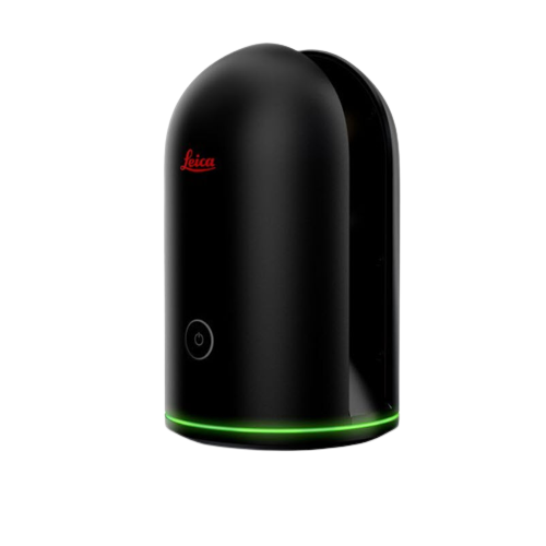
Leica BLK360 G1 Scanner


Leica Cyclone FIELD 360 & BLK360 0419 (25)


Co-branded_Hexagon_Leica_Geosystems_logo_pic_1347x280


  • 360,000 points of data captured per second

  • 200 ft range for scanning large areas

  • Secure mounting for upright, sideways, or upside down scanning

  • Built-in FLIR sensor captures thermal data

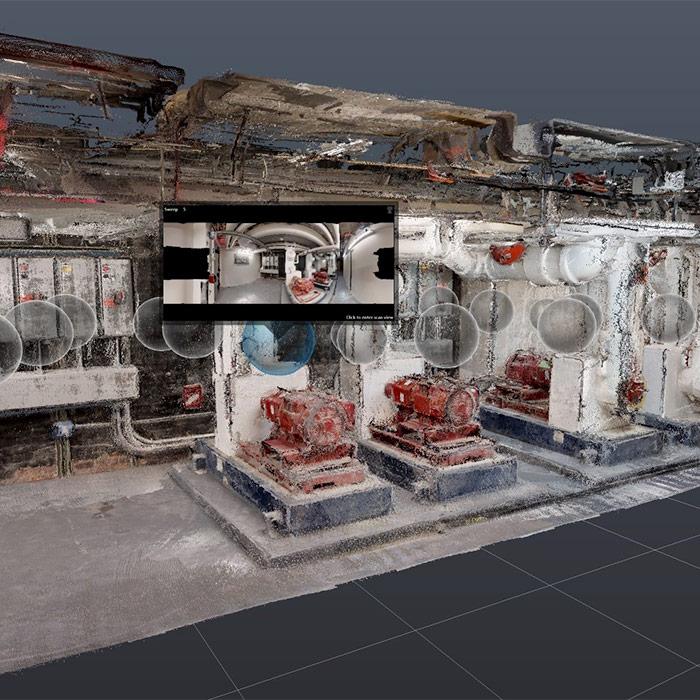
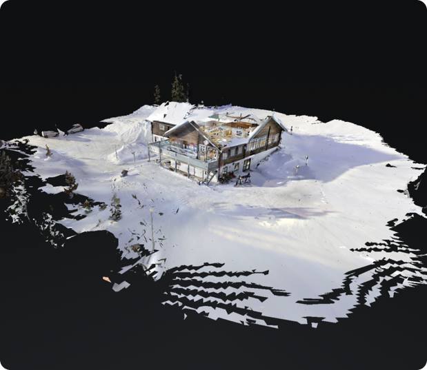
  • Accurately capture as-built conditions

  • Capture point clouds for scan-to-BIM

  • Monitor construction progress

Get a personalized BLK360 quote

See custom pricing and financing options for a Leica BLK360

Experience the BLK360 G1

The first generation BLK360 is LiDAR-based. It delivers in-depth and accurate data. 

Scan the world around you with full-color panoramic images overlaid on a highly-accurate point cloud.

Since it is small, lightweight, and has removable batteries, you can scan large projects worry-free. 

lecia-e57
leica-outdoors

Highly Compatible

The first-generation BLK360 is compatible with Leica Cyclone software and the Matterport subscription plan. 

This software flexibility, combined with robust laser scanning, makes the BLK360 great for scanning outdoors and in large spaces.

Ease-of-Use

Push-button scanning automatically stitches and registers captured scan data for in-field visualization in the mobile version of Cyclone FIELD 360 and the Matterport App. Then transfer the data seamlessly for final processing.

Simplified Data Collection

Two-in-one 360º image documentation and laser scan data.

Portability

Flexibility to scan wherever, whenever with the small, lightweight imaging laser scanner that fits into a messenger bag.

Interoperability

Fully compatible with the Lecia Geosystems High-Definition Surveying (HDS) software suite, Matterport, and Autodesk’s design solutions.

PHYSICAL  SPECS

All specifcations are subject to change without notice.

All accuracy specifcations are one sigma unless otherwise noted.

* at 78% albedo


GENERAL

Imaging scanner 3D scanner with integrated spherical imaging system and thermography

panorama sensor system

DESIGN & PHYSICAL

Housing Black anodized aluminium

Dimensions Height: 165 mm / Diameter: 100 mm

Weight 1kg

Transport cover Hood with integrated foorstand

Mounting mechanism Button-press quick release


OPERATION

Stand-alone operation One-button operation

Remote operation iPad app, Apple iPad Pro® 12.9”/iOS 10 or later

Wireless communication Integrated wireless LAN (802.11 b/g/n)

Internal memory Storage for > 100 setups

Instrument orientation Upright and upside down


POWER

Battery type Internal, rechargeable Li-Ion battery (Leica GEB212)

Capacity Typically >40 setups


DATA ACQUISITION

Live image and scanned data streaming

Live data viewing and editing

Automatic tilt measurements

SCANNING

Distance measurement system High speed time of fight enhanced by Waveform Digitizing (WFD) technology

Laser class 1 (in accordance with IEC 60825-1:2014)

Wavelength 830 nm

Field of view 360° (horizontal) / 300° (vertical)

Range* min. 0.6 - up to 60 m

Point measurement rate up to 360’000 pts / sec

Ranging accuracy* 4mm @ 10m / 7mm @ 20m

Measurement modes 3 user selectable resolution settings


IMAGING

Camera System 15 Mpixel 3-camera system, 150Mpx full dome capture, HDR, LED fash Cali-brated

spherical image, 360° x 300°

Thermal Camera FLIR technology based longwave infrared camera

Thermal panoramic image, 360° x 70°


PERFORMANCE

Measurement speed < 3 min for complete fulldome scan, spherical image & thermal image

3D point accuracy* 6mm @ 10m / 8mm @ 20m


ENVIRONMENTAL

Robustness Designed for indoor and outdoor use

Operating temperature +5 to +40° C

Dust/Humidity Solid particle/liquid ingress protection IP54 (IEC 60529)

Request a Leica BLK360 Quote